Home
Birds eye view of the Concept Design
Overview of the designs
This page shows the project study area and provides high level birds eye views of the proposals for Ardrossan Connections.
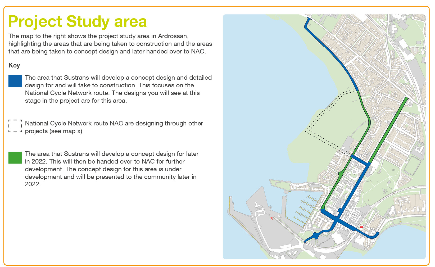
The image above highlights the area that the proposals have been developed for and Sustrans will take through detailed design and construction. This includes part of Princes St, Glasgow St, Barr St and North Crescent Road.
Design Objectives
The following design objectives were developed from key themes that came out of what the community have told us is important to them and should be addressed in the designs.
Objective 1
Provide a safe, accessible, attractive and connected National Cycle Network route through the centre of Ardrossan.
Objective 2
Create a National Cycle Network route and public realm in the centre of Ardrossan that work well together with other elements of Ardrossan’s transport infrastructure.
Objective 3
Celebrate Ardrossan’s identity and create a welcoming and attractive public realm in the centre of Ardrossan.
Objective 4
Create a National Cycle Network route through Ardrossan that is coordinated with other development projects being progressed in the town.
Have your say?
The next three images show an overview of the designs. They have been split into three locations. Then share your views below and on the more detailed proposals. You can also view the designs by watching this video: Ardrossan Connections Walking & Wheeling Audit: Bird’s eye view of the Concept Design - YouTube
North Crescent Road
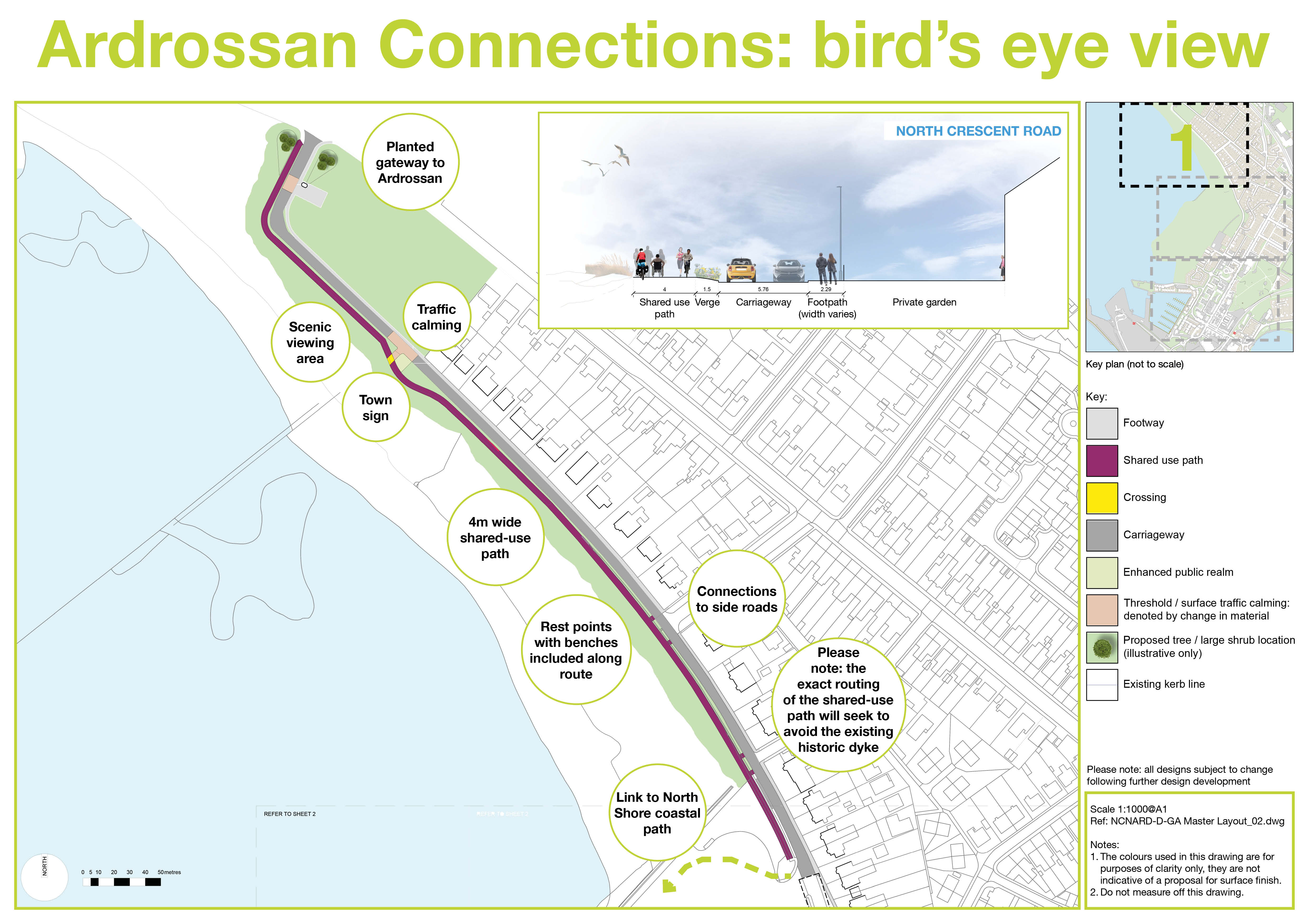
Barr St

Princes St & Glasgow St
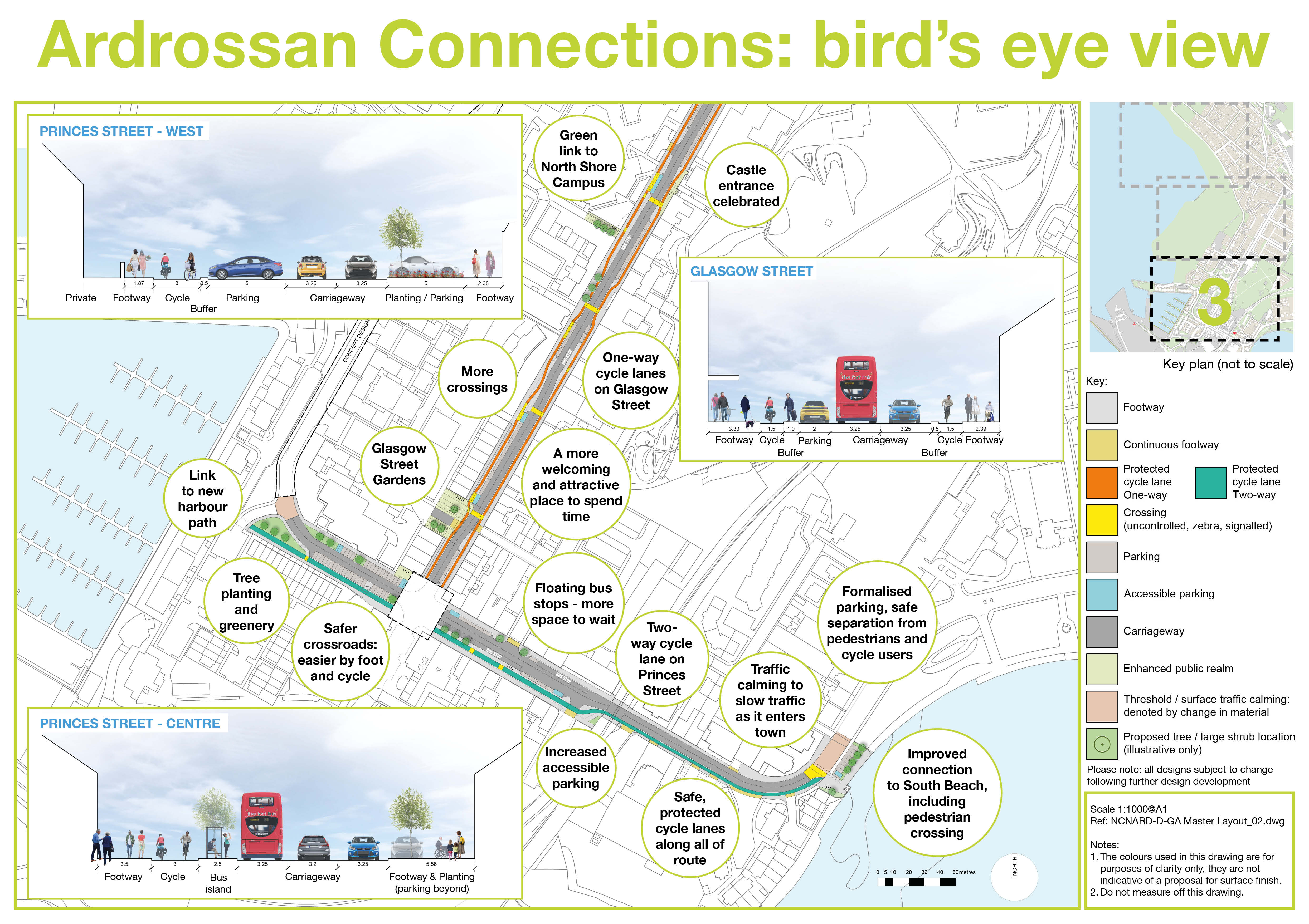
*Please note all designs are subject to further design development.
View the Designs as PDF
To view the design boards as PDFs click here.
This engagement phase has finished

...